Hüyük | |
|---|---|
District and municipality | |
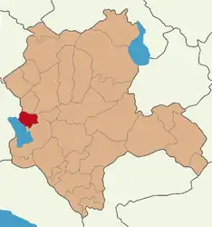 Map showing Hüyük District in Konya Province | |
 Hüyük Location in Turkey  Hüyük Hüyük (Turkey Central Anatolia) | |
| Coordinates: 37°57′07″N 31°35′45″E / 37.95194°N 31.59583°E | |
| Country | Turkey |
| Province | Konya |
| Government | |
| • Mayor | Mehmet Çiğdem (AKP) |
| Area | 443 km2 (171 sq mi) |
| Elevation | 1,250 m (4,100 ft) |
| Population (2022)[1] | 15,144 |
| • Density | 34/km2 (89/sq mi) |
| Time zone | TRT (UTC+3) |
| Postal code | 42690 |
| Area code | 0332 |
| Website | www |
Hüyük, also Höyük (Turkish: höyük, "tumulus, burial mound"), is a municipality and district of Konya Province, Turkey.[2] Its area is 443 km2,[3] and its population is 15,144 (2022).[1]
Composition
There are 23 neighbourhoods in Hüyük District:[4]
- Akdağ
- Bahçelievler
- Başlamış
- Budak
- Burunsuz
- Çamlıca
- Çavuş
- Çukurkent
- Cumhuriyet
- Değirmenaltı
- Göçeri
- Görünmez
- İlmen
- İmrenler
- Kıreli
- Köşk
- Mutlu
- Pınarbaşı
- Selki
- Suludere
- Tolca
- Ulupınar
- Yenice
References
- 1 2 "Address-based population registration system (ADNKS) results dated 31 December 2022, Favorite Reports" (XLS). TÜİK. Retrieved 19 September 2023.
- ↑ Büyükşehir İlçe Belediyesi, Turkey Civil Administration Departments Inventory. Retrieved 19 September 2023.
- ↑ "İl ve İlçe Yüz ölçümleri". General Directorate of Mapping. Retrieved 19 September 2023.
- ↑ Mahalle, Turkey Civil Administration Departments Inventory. Retrieved 19 September 2023.
External links
- District governor's official website (in Turkish)
- District municipality's official website (in Turkish)

This article is issued from Wikipedia. The text is licensed under Creative Commons - Attribution - Sharealike. Additional terms may apply for the media files.